A MOUNTAIN PLAYGROUND
Blessed by fortune and good luck, Asheville just happens to be located in a pocket of Mother Nature’s beauty and offers no shortage of ways to enjoy her splendor.
BY BILL KOPP
***
Well before Europeans explored the mountains of North Carolina, native Cherokee tribes gravitated toward a scenic and sometimes wild northward-flowing river, calling it Tah-kee-os-tee, meaning “racing waters.” When white settlers arrived, they gave it a different name, the French Broad River, describing both its breadth and width and location within what was once French territory.
For generations, the French Broad River served as a valuable resource for the residents of Asheville and Western North Carolina, providing water, food and transportation. Today, for both residents and millions of annual tourists, it’s also a playground—a paradise for paddlers, tubers, anglers and others who find a way to enjoy the current as it winds its way through Asheville before heading northeast to Tennessee, flowing into the mighty Mississippi River and emptying into the Gulf of Mexico.
The French Broad is just one feature of the region that forms the topography and geography that attract nature lovers and the more adventurous set that hike, bike, camp, climb and zipline their way through the forest. Nestled in the Blue Ridge Mountains, Asheville is situated next to two national forests, Pisgah and Nantahala, and sits an hour’s drive from the Great Smoky Mountains National Park. Mt. Mitchell, meanwhile, the tallest mountain east of the Mississippi, is just 25 miles away as the crow flies, and the beautiful Blue Ridge Parkway curves along the southern and eastern parts of the city, offering stunning views to both motorists and hikers alike.
Blessed by fortune and good luck, Asheville just happens to be located in a pocket of Mother Nature’s beauty and offers no shortage of ways to enjoy her splendor. And understanding those features, and how they formed, helps us gain a deeper appreciation for what they offer.
Ol’ Man River
All along the route of the French Broad River, which is unique among its peers in that it travels south to north, adventure seekers can find many recreational options.
In Asheville proper, lazy river floating is a popular summer pastime, with rental outfitters providing the necessary gear and a number of breweries located on the river banks ready and willing to provide refreshment.
North of the city, the river enters an area prime for the more challenging sport of kayaking. Just beyond the limits of Asheville, Ledges Whitewater River Park offers Class II and II+ rapids. The park is a component of a paddling and camping network called the French Broad River Paddle Trail, encompassing nearly 150 miles of camp and access sites, many of which can only be reached by raft or kayak.
Closer to Marshall, about 30 minutes north of Asheville, the river offers even more opportunities for paddling and kayaking. And between Barnard and Hot Springs, a bit further north than that, there are nine rapids on the river.
Apart from being a whole heck of a lot of fun, one of the French Broad’s other claims to fame is that it’s among the oldest rivers in the world. Some say it’s the third oldest river in the world; others say it’s the fifth oldest. Either way, it dates back many millions of years. “There is a real possibility that the French Broad… is hundreds of millions of years old,” wrote Tim Means, a former Pack Memorial Library associate, in a 2018 article for the Asheville Citizen-Times.
Ultimately, however, its age isn’t its greatest feature.
More than two decades ago, I took a rafting trip down a section of the French Broad, experiencing the mild thrill of the river’s Class III and, for a brief moment, Class IV rapids. The river guide, in addition to knowing how to keep a raft off the rocks and away from eddies, knew quite a bit about the natural history of the French Broad. I was surprised to learn that its river basin is home to a stunning amount of biodiversity, perhaps even akin to what’s seen in the Amazon River Basin.
According to documents published by the North Carolina Office of Environmental and Public Affairs, the nearly 3,000-square-mile French Broad River Basin encompasses nearly 4,000 miles of streams and more than 1,700 acres of natural and man-made lakes. All of that land and water—much of it protected wilderness—is home to a remarkable variety of flora and fauna. Among the most notable are aquatic salamanders, which can be quite cute in a Star Wars alien kind of way, along with freshwater drum and mooneye fish, the rare sharphead darter and endangered Appalachian elktoe mussel.
Increased population along the river as well as runoff from agricultural operations have led to
pollution in the French Broad. But conservation initiatives, including efforts by the nonprofit Waterkeepers Carolina, seek to preserve the balance between commerce and conservation, protecting livelihoods as well as the environment so that all stakeholders can coexist into future generations.
Scott “Doc” Varn spearheaded the recent Preserving a Picturesque America initiative, a project designed to capture the scenic grandeur of the United States via paintings and engravings. In 2021, the Asheville-based artist and conservationist hosted an art exhibit, “Preservation Through Art: Along the French Broad,” inviting artists to showcase their renderings of the river to help raise money for conservation efforts.
“Strolling the riverbanks or paddling their waters brings contentment, but also encourages reconnection of how the natural world functions,” Varn told me. “There’s so much diversity that one only has to pick a section that suits them.”

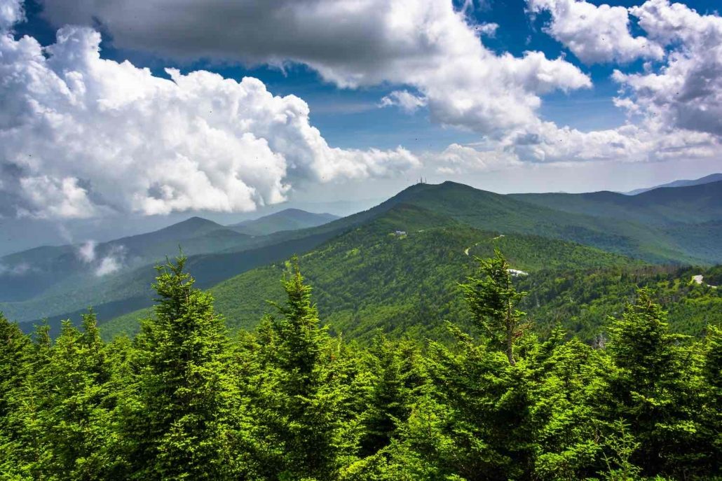
View of the Appalachian Mountains from the Observation Tower at Mount Mitchell, North Carolina.
The Eastern Peak
For generations, the Cherokee people referred to the highest peak of the Appalachian Mountains as Attakula (“leaning wood”). When European settlers came upon it, they named the mountain Black Dome. Today it is known as Mount Mitchell, after the University of North Carolina professor who explored the region in the 1830s. And thanks to modern and accurate scientific measurement, North Carolina’s highest peak is now recognized at the highest point of the mainland U.S. east of the Mississippi River, with a verified elevation of 6,684 feet. On a clear day, views can extend as far as 85 miles.
As the crow flies, Mount Mitchell’s summit is a mere 25 miles northeast of Asheville, but getting there by car requires a drive more than twice that length. Happily, those routes are quite scenic in their own right, passing through either the charming towns of Old Fort or Barnardsville.
The summit and surrounding park are usually closed to vehicles in winter because of weather. The average January high temperature at the summit is 34° F, with average January snowfall of 19.2 inches. During warmer months, when the road is open, the gorgeous two-lane Blue Ridge Parkway offers a relaxing 45 mile per hour drive from Asheville to Mount Mitchell. The trip is dotted with many designated roadside pull-offs, tunnels and other points of interest. The drive takes about an hour nonstop, but you’ll almost certainly want to pause to take in the crisp, clean air and panoramic views.
Those views include a popular destination not far from Mount Mitchell, Craggy Gardens. The Blue Ridge Parkway’s official website describes the attraction at Milepost 364.4 as “the most spectacular floral display” along the entire parkway. And that’s no hyperbole; as the weather warms up in June, visitors flock to the site (elevation 5,500 feet) for cooler temperatures, a leisurely up- hill hike and vivid purple and pink flower- ing of Catawba rhododendron.
Falling Waters
At the southern end of the French Broad River Basin lies Transylvania County. It’s rightly referred to as the “Land of Waterfalls,” thanks to more than 250 waterfalls scattered around the county. Many of those cascading waters are easily accessible by car, possibly entailing a short walk, and many more can be reached by way of a modest hike. Regardless of how you get there, the waterfalls are a majestic display of both power and beauty and warrant as many pictures as you can take.
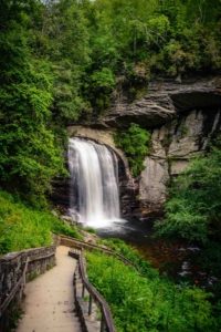
The most well-known among the dozens of falls is Looking Glass Falls, situated within the Pisgah National Forest and named for its mirror-like appearance as well as the the stream from which the falls plunge, Looking Glass Creek. Whitewater Falls nears Cashiers, N.C., meanwhile, is the tallest waterfall east of the Rockies with a height of 411 feet. Rainbow Falls isn’t nearly as high, but when sunlight hits the water spray, you’ll under- stand how it earned its name.
The majestic Triple Falls in DuPont Recreational State Forest was inaccessible to the general public for several years, but is now one of the region’s showpieces. Until 1996, the land surrounding the falls was owned by multinational chemical company DuPont, which had a manufacturing plant on the property. In 2000, the company arranged the sale of the 12,500-acre forest to the state of North Carolina, and the state designated the land as DuPont State Recreational Forest.
Today DuPont is home to more than 83 miles of multi-use trails, enjoyed by mountain bikers, horseback riders and hikers. And legal access to the forest has enabled visitors to witness Triple Falls, one of few waterfalls in the region where visitors can stand in the middle of it.
Maine To Georgia, By Way Of WNC
No discussion of the outdoor wonders of the region would be complete without mention of the historic Appalachian Trail. The 2,200-mile-long trail, the longest hiking-only trail in the world, winds through Western North Carolina and along the North Carolina-Tennessee border for a to- tal of 320 miles. More than 1,000 hikers complete the entire length of the trail each year, but many more traverse shorter segments, including the North Carolina section. And the trip brings hikers in contact with the region’s natural beauty.
One popular highlight on the North Carolina section of the trail is Max Patch Mountain near Hot Springs, northwest of Asheville. An easy 1.7-mile down-and-back trail from a parking area leads you to a 4,600-foot bald that is nothing short of impressive. Offering 360-degree vistas of Mount Mitchell to the east and the Great Smoky Mountains to the southwest, it’s covered with ferns and grasses that make it a perfect place for a picnic.
“From the dense forests and rich biodiversity of the Great Smoky Mountains to panoramic views from grassy balds like Max Patch, the landscapes of Western North Carolina are some of the most memorable sections for any AT visitor,” says Jordan Bowman, director of communications for the Appalachian Trail Conservancy.
Enduring Beauty, Lasting Memories
There’s much more to explore in the region. Western North Carolina offers myriad other opportunities to enjoy the great outdoors. Swimming and boating in Lake Lure, Lake James and Fontana Lake; winter skiing at six resorts nearby; ziplining and even a few caves are just part of what help make the westernmost part of the Tar Heel State a favorite of nature enthusiasts. Time spent outdoors here brings treasured memories that endure.
Author of two books and contributor to magazines and alt-weeklies in the U.S. and U.K., Bill Kopp writes about arts, lifestyle, music and pop culture. He enjoys meeting (and writing profiles of) anyone who’s passionate about what they do.
Save
Save
Save
Save
Save
Save
Save
Save
Save
Save

Looking Glass Falls in Pisgah National Forest
THE WEEKLY REVEL
Sign up for your free handpicked guide to enjoying life around Asheville.
Available weekly from May to October.


